
Global Mapper

vector, raster, elevation, LiDAR
Software Development
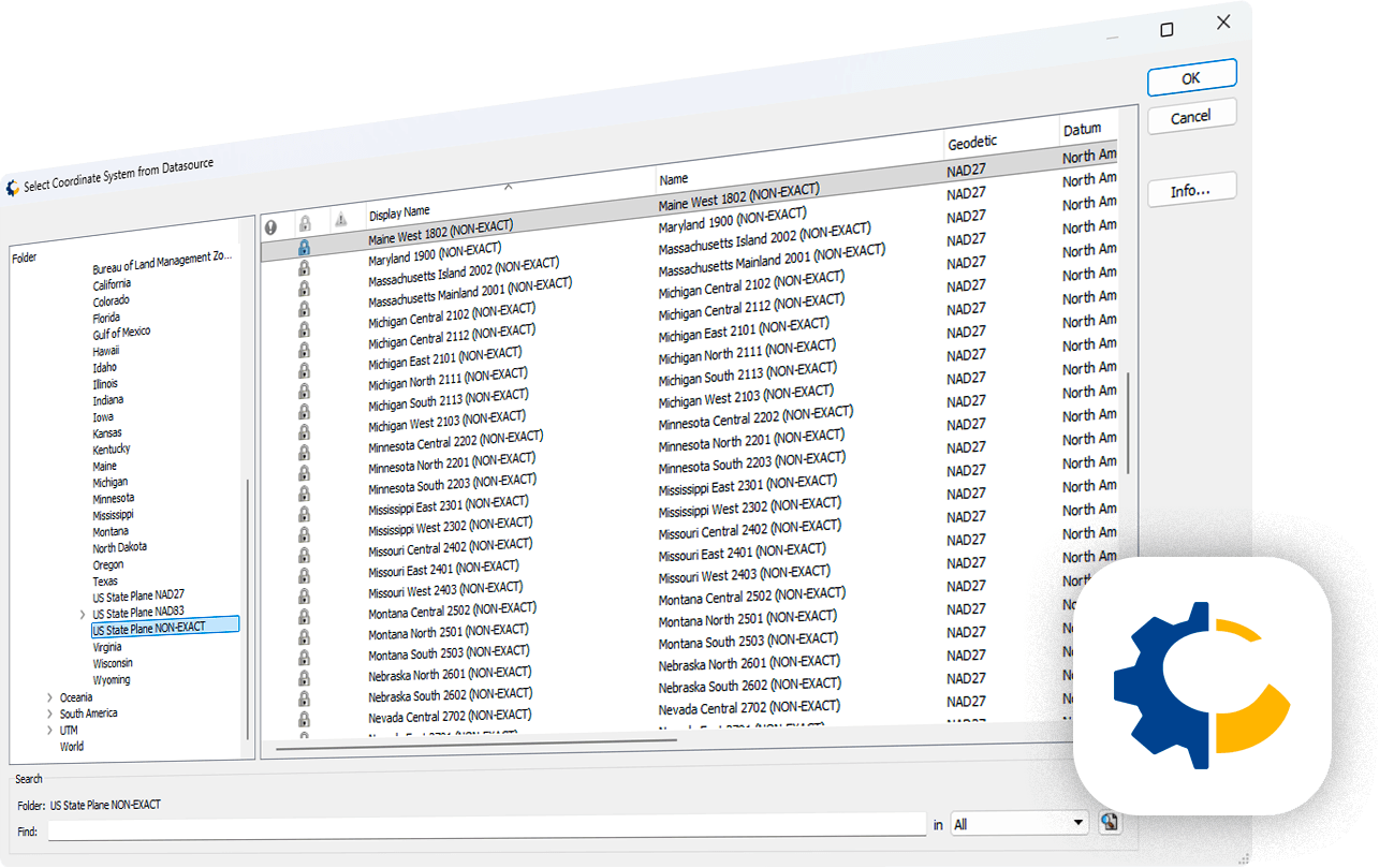
integrated GeoCalc geodetics
Global Mapper Is Used
Overview
Global Mapper® is a cutting-edge GIS application developed by Blue Marble Geographics of Hallowell, Maine. It provides both novice and experienced geospatial professionals with a comprehensive array of spatial data processing tools and access to an unparalleled variety of data formats. An intuitive user interface and logical layout smooth the learning curve so that users are up-and-running in a matter of days, while the underlying engine handles multi-gigabyte imagery mosaics, elevation grids, and LiDAR point clouds on ordinary desktop hardware.
Organizations of any size see a rapid return on investment through efficient data processing, accurate map creation, and optimized spatial data management. Global Mapper is offered as a single affordable license — with the Global Mapper Pro extension adding advanced LiDAR classification, feature extraction, terrain painting, and Pixels-to-Points photogrammetry — and version 27 embeds Blue Marble's GeoCalc geodetic library directly into the application, eliminating the need for separate coordinate transformation tools and bringing survey-grade geodetic accuracy into every workflow.
Key Features & Global Mapper Capabilities
Over 300 vector, raster, elevation, and point cloud formats are supported natively — no add-ons or additional licenses required. Users can load, combine, crop, reproject, and tile virtually any data they encounter, and new or modified formats are added continuously so the software never falls behind the data being produced.
Global Mapper streams a vast library of built-in online sources directly into the workspace: worldwide aerial and satellite imagery, global elevation datasets, topographic maps, Landsat scenes, land cover, and aviation charts — providing instant geographic context without downloading or preparing basemap data manually.
Flexible visualization of 2D and 3D data with customizable shaders, draped imagery, and animation creation. The 3D viewer records HD fly-through videos of point clouds, terrain, and draped rasters, while the layout tools produce print-ready map sheets, PDF exports, and web tile output for sharing results.
A complete digitizing toolkit for point, line, and polygon creation, plus specialized geometric tools for range rings, grids, and buffers. The Spatial Operations tool performs Intersection, Union, Difference, and Symmetrical Difference along with spatial predicates and transformations for complex multi-layer comparisons.
Multi-band layer creation, pan sharpening, tiling, mosaicing, image feathering, contrast adjustment, and histogram matching blend datasets captured at different times or with different sensors. Raster calculation supports NDVI, NDWI, NBR, other common indices, and custom formulas, while Raster Reclassify converts pixel values by rule.
Dynamic terrain visualization from imported elevation data and TIN surfaces generated from 3D vectors. Generate contours with custom intervals, identify peaks and depressions, and run watershed delineation, view shed and line-of-sight analysis, cut-and-fill volume calculation, and cross-sectional profiling directly on the terrain.
Load, filter, and classify massive LiDAR datasets with automatic ground, building, powerline, and vegetation classification, noise removal, thinning, and point cloud registration. Extract features, generate breaklines and terrain models, and reconstruct 3D buildings — with the most advanced tools available in the Global Mapper Pro extension.
The Global Mapper scripting language and batch conversion tools automate repetitive processing across thousands of files, and the Python SDK opens the engine to custom development. With Blue Marble's GeoCalc geodetic library now integrated, coordinate system transformations and geodetic accuracy are handled inside Global Mapper without separate tools.
Global Mapper Platform Overview
An overview of Global Mapper — how Blue Marble Geographics' all-in-one GIS application handles data import, terrain and LiDAR analysis, map production, and automation in a single desktop environment.
Deep Dive: LiDAR, Terrain & Geodetic Processing
The defining strength of Global Mapper is breadth without fragmentation: data translation, terrain modeling, LiDAR classification, photogrammetry, geodetic transformation, cartography, and automation all live inside one application and one license. Workflows that normally cross three or four specialized products are completed end to end, with the same coordinate handling and the same interface at every step.

Point Cloud Classification & Feature Extraction
Global Mapper Pro applies automated classification to raw LiDAR returns — separating ground, vegetation, buildings, powerlines, and poles — then extracts vectorized features from the classified cloud. Building footprints and 3D models, powerline catenaries, tree points with height and crown metrics, and stockpile volumes are derived directly from the point data, replacing hours of manual digitizing with repeatable, parameter-driven processing.

Terrain Modeling & Hydrologic Analysis
Elevation grids and TIN surfaces built inside Global Mapper support the full range of terrain analytics: slope, aspect and curvature rasters, contour generation, watershed and stream network delineation, flow accumulation, and flood-fill modeling. Cut-and-fill volume calculation and terrain painting allow engineers to design and quantify grading scenarios against measured survey data in a single environment.

Geodetic Accuracy with GeoCalc
Blue Marble's GeoCalc geodetic engine — the same library licensed by GIS and CAD vendors worldwide — is embedded in Global Mapper. It provides thousands of datums, projections, geoid models, and grid-based transformations, along with time-dependent and plate-motion aware transformations, so data captured in different reference frames aligns to survey-grade tolerances without exporting to an external coordinate conversion tool.

Drone & UAV Photogrammetry Workflows
The Pixels-to-Points tool turns overlapping drone imagery into dense point clouds, orthoimages, and 3D meshes entirely within Global Mapper. Combined with GPS-tagged photo import, image rectification, and terrain generation, survey teams move from a completed flight to a measurable deliverable in the same software they use for mapping — no separate photogrammetry suite or cloud processing subscription required.

Batch Processing & Workflow Automation
Global Mapper scripts chain together loading, reprojection, clipping, analysis, and export operations that run unattended across entire data directories. Scheduled scripts, batch format conversion, and the Global Mapper Python SDK let organizations standardize deliverables, enforce coordinate system policy, and process recurring datasets at a fraction of the manual effort.

Field Data Capture with Global Mapper Mobile
Global Mapper Mobile extends the desktop workspace to iOS and Android devices. Prepared map packages — including imagery, terrain, and editable vector layers — are taken offline into the field, where crews collect attributes, photos, and GPS positions. Completed packages sync back to the desktop, closing the loop between office analysis and field verification without third-party data collection platforms.
Benefits
- ✓One affordable license covers over 300 data formats — no per-format extensions, no separate extension pricing for core mapping, terrain, and raster work
- ✓Exceptionally fast performance on very large datasets — multi-gigabyte LiDAR tiles, imagery mosaics, and elevation grids open and render on standard desktop hardware
- ✓Low learning curve: an intuitive, logically organized interface means new users are productive within days rather than after months of formal training
- ✓Blue Marble's GeoCalc geodetic library is built in, delivering survey-grade coordinate transformations without buying or maintaining a separate geodetic toolkit
- ✓Complete LiDAR and photogrammetry pipeline in the Pro extension — classification, feature extraction, and Pixels-to-Points reconstruction from drone imagery
- ✓Scripting, batch conversion, and the Python SDK automate repetitive deliverables and enforce consistent processing standards across teams
- ✓Perpetual licensing option with optional maintenance — no forced subscription and no loss of access to the software when maintenance lapses
- ✓Streamed online imagery, elevation, and topographic sources provide immediate geographic context with no basemap preparation
- ✓Global Mapper Mobile connects office and field with offline map packages, GPS capture, and two-way synchronization
- ✓Responsive direct technical support from Blue Marble Geographics, plus extensive knowledge base, tutorials, and certified training courses
Licensing Model
Single-seat license covering the full core application: 300+ formats, online data streaming, vector editing and spatial operations, raster processing, terrain creation and analysis, cartographic layout, and scripting. Available as a perpetual license with optional annual maintenance, or as a term subscription.
Extension license adding advanced LiDAR classification and feature extraction, terrain painting, breakline calculation, Pixels-to-Points photogrammetry, point cloud registration, and 3D model reconstruction. Layered on top of a Standard license for teams working with UAV and LiDAR data.
Concurrent-use licensing served from the organization's own license manager, allowing a pool of seats to be shared across departments and locations. Ideal for teams with many occasional users, and available with borrowing for offline field laptops.
The Global Mapper SDK and Python SDK license the underlying engine for embedding into custom applications and automated pipelines, while Global Mapper Mobile (with the Pro in-app upgrade) extends licensed workflows to iOS and Android field devices.
Deployment Options
Global Mapper for Windows
Installed 64-bit desktop application for Windows workstations and laptops. All processing runs locally with no dependency on internet connectivity except for streamed online sources — suited to sensitive data, disconnected offices, and very large local datasets.
Floating License & Citrix / VDI
Concurrent licenses served from an internal license manager and deployment onto virtual desktops, terminal servers, and cloud workstations. Enables centralized data storage, standardized configuration, and shared access to seats across distributed teams.
Global Mapper Mobile
iOS and Android companion app for offline field use. Desktop-prepared map packages with imagery, terrain, and editable layers are taken into the field for GPS-based data capture, then synchronized back to the desktop workspace for analysis and delivery.
Supported Formats & Integrations
Industry Applications
| # | Industry | Application & Business Impact |
|---|---|---|
| 01 | Surveying & Engineering | Survey firms use Global Mapper to reconcile total station, GNSS, and LiDAR observations into a single georeferenced model, generate contours and cross sections, calculate cut-and-fill volumes, and deliver CAD-ready outputs. Built-in GeoCalc transformations ensure that legacy datums, local grids, and modern reference frames align to survey tolerances on every project. |
| 02 | Utilities & Telecom | Utility and telecom operators classify powerline corridors from LiDAR, extract conductors and structures, run vegetation encroachment and clearance analysis, and model line-of-sight for microwave and wireless links. Terrain and viewshed analysis support tower siting and coverage planning, while batch scripts keep corridor deliverables consistent across thousands of kilometers of network. |
| 03 | Mining & Aggregates | Mine planners and quarry operators compute stockpile and excavation volumes from drone-derived point clouds, monitor pit progression over time with repeat surveys, model haul road grades, and produce compliance reporting maps. Pixels-to-Points reconstruction turns each UAV flight into a measurable surface within hours of landing. |
| 04 | Forestry & Natural Resources | Forest managers derive canopy height models, individual tree points with crown metrics, and stand-level inventory statistics from LiDAR, and combine them with multispectral indices such as NDVI and NBR to assess vigor, fire fuel loads, and post-disturbance recovery across large ownerships. |
| 05 | Government & Municipal GIS | Local and national agencies use Global Mapper as an affordable, high-capacity workhorse for parcel and infrastructure mapping, addressing and geocoding, format conversion between agency standards, and production of print and PDF map series. Its low licensing cost lets departments equip every technician rather than sharing scarce seats. |
| 06 | Environmental & Hydrology | Environmental consultants delineate watersheds and stream networks, model flood extents with flood-fill and terrain manipulation, map wetlands and land cover change, and quantify shoreline and channel migration by differencing elevation surfaces from successive surveys. |
| 07 | Oil, Gas & Pipelines | Pipeline and exploration teams manage seismic and well data, plan routes across terrain with slope and constraint analysis, generate elevation profiles for hydraulic design, and prepare regulatory alignment sheets. Broad format support and geodetic rigor simplify exchange of data between operators, contractors, and surveyors. |
| 08 | Archaeology & Research | Researchers use bare-earth LiDAR filtering, multi-directional hillshading, and custom shaders to reveal subtle surface features beneath vegetation, then document findings with high-resolution map layouts, 3D fly-through videos, and precisely georeferenced site records suitable for publication and archival. |
| 09 | Emergency Management & Defense | Response and defense organizations build offline map packages for field teams, run line-of-sight and viewshed analysis for situational awareness, ingest DTED and NITF products alongside commercial imagery, and produce rapid damage-assessment mapping from post-event aerial and drone collections. |
Summary
Global Mapper occupies a distinctive position in the geospatial market: the functional depth of a professional GIS and the format breadth of a dedicated data translator, delivered in one lightweight application at a fraction of the cost of comparable platforms. Over three decades of development by Blue Marble Geographics have produced a tool that surveyors, engineers, utilities, foresters, miners, and government technicians reach for daily — because it opens whatever data arrives, processes it quickly, transforms it with genuine geodetic rigor through the integrated GeoCalc engine, and exports it in whatever form the next stakeholder requires. With the Pro extension adding LiDAR classification, feature extraction, and drone photogrammetry, Global Mapper covers the complete path from raw field collection to finished, defensible deliverable inside a single perpetual license.